CONTACT INFORMATION:

Our office is open 9 a.m. - 4 p.m. M-F

703-324-9300 | TTY711

12055 Government Center Pkwy, Suite 755
Fairfax, VA. 22035

JoAnne Fiebe,Program Manager

Richmond Highway Commercial Revitalization District

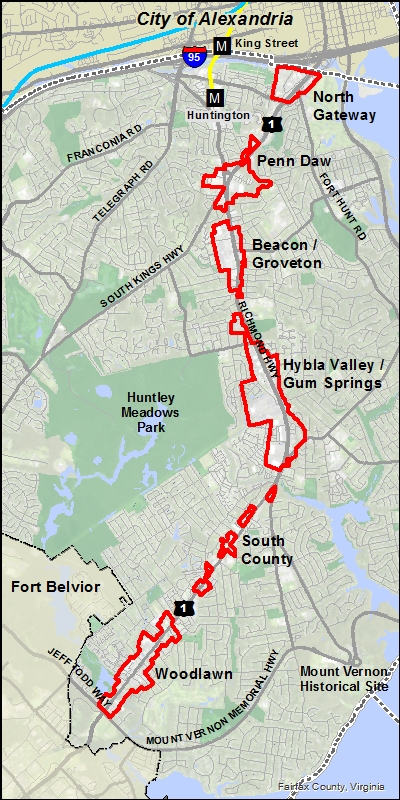
Richmond Highway Location Map

About

The Richmond Highway corridor is part of the historic Route 1 that serves the east coast from Florida to Maine.  The nine mile portion in Fairfax County extends from the Capital Beltway and the Huntington Transit Station Area to Fort Belvoir, a US Army base.  There are many assets in the Richmond Highway area such as historic Mount Vernon and Gum Springs community and significant environmental features. Two zoning overlays include a Commercial Revitalization District (CRD) and a Highway Corridor (HC) district. The CRD designation is applied mostly within the corridor’s six Community Business Centers (CBCs).

Adopted in 2018, the Embark Plan contains a new vision for the corridor that integrates high quality urban design and transportation to create walkable, mixed-use centers in many of the CBCs.  Roadway improvements and a new Bus Rapid Transit system are being planned to improve mobility.

Quick Facts:

Total Area: 698.90 Acres

Total Population:  8,586

Median Household Income:  $67,396

Median Home Value:  $337,317

Median Age:  32.2

Population 25+ with College Degree or More:  39.65%

Total Non-Housing Consumer Spending:  $94.14 Million

All values are 2020 Estimates for within CRD boundaries provided by ESRI Business Analyst Desktop.

EMBARK Comprehensive Plan

Embark Richmond Highway was an initiative focused on creating a multimodal future for Richmond Highway Corridor where residents, workers, and visitors can walk, bike, or drive to the places they want to go. This effort responded to recommendations from the Route 1 Multimodal Alternatives Analysis, conducted by the Virginia Department of Rail and Public Transportation (DRPT), and assessed and refined the recommendations from the study by providing more detailed guidance in the Comprehensive Plan for the implementation of transit in the corridor. Embark Richmond Highway included coordination with the Virginia Department of Transportation (VDOT) and federal agencies to conduct Environmental Assessments (EAs).

The Embark Richmond Highway Study was adopted on March 20, 2018.

Richmond Highway Corridor Improvement Projects

Find out the latest from VDOT about roadway, bicycle, and pedestrian improvements for a portion of Richmond Hwy from Sherwood Hall Ln to Jeff Todd Wy.

Southeast Fairfax Development Corporation

Develops, implements and supports projects that drive economic growth on the corridor

Richmond Highway Bus Rapid Transit Project

Find out the latest from Fairfax County Department of Transportation on the plans for transit on Richmond Highway.

Other News

  • Façade Improvement Program

The Façade Improvement Program provides matching grants to property owners on Richmond Highway for enhancements to landscaping, signage, parking areas, and building exteriors. An application was approved in January 2018 for the Neighborhood Health Office Building at 6677 Richmond Highway. It is anticipated that this will be the final project for the current program.

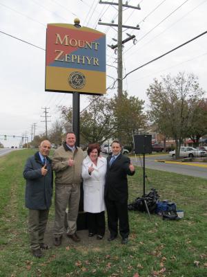
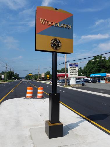
  • Wayfinding ProjectRichmond Highway Way Finding SignRichmond Highway Way Finding Sign

A series of gateway markers and wayfinding signage were installed along the Richmond Highway Corridor to guide travelers and build identity for the corridor. The project was a collaborative effort between the Southeast Fairfax Development Corporation (SFDC) and Fairfax County.